
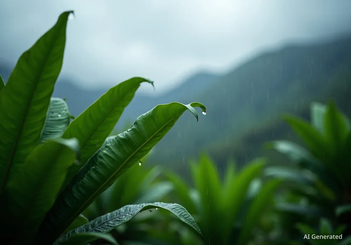
East Hawaiʻi districts are now experiencing the long-awaited wet season, providing a significant relief after an unusually dry period. The dry season, which typically spans from May through September, brought below-average rainfall to much of the Big Island, leading to concerns about drought conditions.
This shift in weather patterns is a welcome change for residents and the environment, particularly in areas like Hāmākua, Hilo, and Puna, which faced the driest conditions on the island during the preceding months.
Key Takeaways
- East Hawaiʻi districts experienced a drier-than-average dry season from May to September.
- Kona district recorded above-average rainfall during the dry season, including the island's highest daily total in September.
- The 2025 dry season was the third driest in the last 30 years for Hawaiʻi.
- A La Niña advisory is in effect, predicting above-normal rainfall for the northwestern half of the state through early spring 2026.
- Weak La Niña events can bring significant rainfall but do not guarantee record-breaking wet seasons.
Dry Season Challenges for East Hawaiʻi
During the dry season, from May through September, rainfall totals were largely below average across the Big Island. The exception was the Kona district, which received its typical summer rainfall amounts. However, eastern areas faced a significant deficit.
September saw most of the island below average in rainfall. The leeward coast and slopes of the Kohala and Kona districts were the only areas reporting typical or above-average precipitation. This contrast highlighted the localized nature of the dry conditions.
Interesting Fact
The Kūlani rain gauge in Mountain View, located in the Puna district, recorded its driest September in its 14-year period of record. This statistic underscores the severity of the dry spell in East Hawaiʻi.
Kona's Exception to the Dry Trend
While East Hawaiʻi struggled with dryness, the Kona district experienced a different story. The rain gauge at Waiaha Stream on the slopes of Kona recorded the highest monthly total for September, reaching 9.41 inches. This figure represents 175% of its average rainfall for the month.
This site also reported the island's highest daily rainfall total on September 1, with 3.64 inches. This single-day event surpassed Mt. Waiʻaleʻale on Kauaʻi for the state's highest daily total that month, a notable occurrence.
"The rainfall during the dry season, which runs from May through September, was mostly below average on the Big Island, except for the Kona district, which reached its typical summer rainfall maximum."
Statewide Rainfall Trends and Drought Severity
Across the Hawaiian Islands, rainfall patterns varied. While the Big Island experienced less rain, Oʻahu and Maui County also saw below-average precipitation during the dry season. Kauaʻi, however, recorded slightly above-average rainfall for the same period.
Overall, the 2025 dry season ranked as the third driest in the last 30 years for the state. This long-term perspective highlights a concerning trend for the islands' water resources and ecosystems.
Drought Impact
The most significant increase in drought severity was observed in Hāmākua and Kaʻū districts on the Big Island. The windward and leeward coasts of Oʻahu also faced increasing drought conditions, indicating a broader regional impact beyond just East Hawaiʻi.
La Niña Brings Hope for the Wet Season
With the official start of the wet season, a La Niña advisory is now in effect. These conditions developed in September and are expected to continue through January and February of 2026. This atmospheric phenomenon often influences rainfall patterns across the Pacific.
Forecasters predict a 55% chance that conditions will transition to the El Niño-Southern Oscillation cycle, or neutral conditions, after February. These neutral conditions are then expected to persist through March, offering a period of more stable weather.
Rainfall Outlook for Early 2026
Rainfall during the wet season is predicted to align with a cold-season La Niña event. Climate models suggest an enhanced probability for above-normal rainfall through early spring 2026. The greatest probabilities for this increased rainfall are concentrated over the northwestern half of the state.
The strength of La Niña plays a crucial role in determining both the amount and distribution of rainfall. Weaker La Niña events have historically favored above-normal rainfall during winter in Hawaiʻi since the 1980s. These weaker events can also lead to more weather systems capable of producing widespread significant rainfall.
- La Niña advisory: In effect through early 2026.
- Rainfall prediction: Above-normal for northwestern Hawaiʻi.
- Transition: 55% chance of neutral conditions after February 2026.
However, weather experts emphasize that even weak La Niña events do not automatically result in Hawaiʻi's wettest wet seasons on record. While beneficial, the rainfall may not always reach historic highs, but it is expected to provide much-needed moisture to the parched areas.
What is La Niña?
La Niña is a climate pattern that describes the cooling of surface ocean waters along the tropical west coast of South America. It is the cold phase of the broader El Niño-Southern Oscillation (ENSO) cycle. La Niña often influences global weather patterns, including rainfall and temperature in different regions.
The arrival of the wet season, coupled with the La Niña advisory, brings a sense of cautious optimism for East Hawaiʻi and other affected regions. The increased rainfall is vital for agricultural health, water reservoirs, and ecosystem recovery after a challenging dry period.