
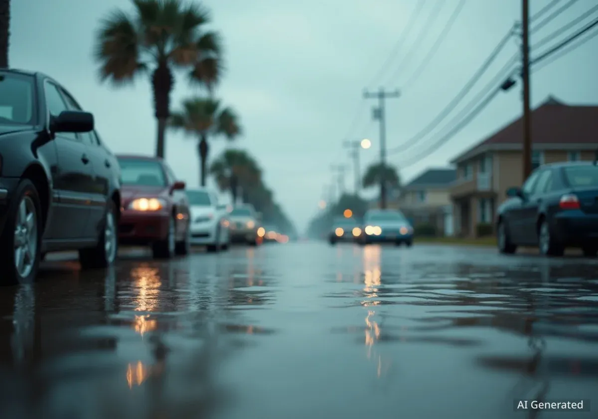
High astronomical tides, known as king tides, caused significant street flooding across coastal communities along South Carolina's Grand Strand on Thursday morning. The predictable event, which occurs several times a year, inundated low-lying areas from Cherry Grove to Pawleys Island, prompting officials to issue warnings for motorists.
The flooding is a result of a specific gravitational alignment of the Earth, moon, and sun. According to meteorologists, these elevated water levels are expected to persist for the next several days, continuing to impact travel and daily routines in vulnerable neighborhoods.
Key Takeaways
- King tides led to significant street flooding in multiple Grand Strand communities, including Cherry Grove, North Myrtle Beach, Garden City, and Pawleys Island.
- The event is a natural phenomenon caused by the gravitational pull when the moon is closest to Earth during a new or full moon.
- Officials have warned drivers to avoid flooded roads to prevent vehicle damage from saltwater and to stop wakes from pushing water into homes.
- Some residents believe that inadequate local drainage systems are making the effects of the tidal flooding worse.
Understanding the Science Behind King Tides
King tides, scientifically referred to as perigean spring tides, are not caused by storms but by a predictable alignment of celestial bodies. They happen when the moon is at its perigee—its closest point to Earth in its monthly orbit—and coincides with a new or full moon.
This alignment creates a stronger-than-usual gravitational pull on the Earth's oceans, resulting in exceptionally high tides. While a natural occurrence, their effects are becoming more pronounced in many coastal areas due to rising sea levels, which provide a higher starting point for the tides to build upon.
A Predictable but Powerful Event
Unlike flooding from hurricanes or heavy rainfall, king tides are forecast well in advance. They serve as a preview of what could become routine high tides in the future as sea levels continue to rise, making them a critical tool for coastal planning and infrastructure assessment.
Widespread Impact Across Coastal Neighborhoods
On Thursday, the effects of the king tides were visible across the region. Officials noted that when the tide level surpasses 8 feet, certain areas are particularly susceptible to flooding. Reports and photos from the scene showed streets covered in several inches of saltwater.
Several key areas experienced significant inundation, disrupting local traffic and access. The most affected locations included:
- Cherry Grove: Areas near Lake Drive and 50th Avenue North, as well as the region between Sea Mountain Highway and Hog Inlet.
- North Myrtle Beach: Streets between 48th and 46th avenues south were particularly vulnerable.
- Garden City: North and South Dogwood Drive saw substantial water coverage, an ongoing issue for the community.
- Murrells Inlet: Minor flooding was reported on Dolphin Street and Basin Drive.
- Pawleys Island: Myrtle Avenue was among the streets affected, with the local police department sharing images of the high water.
Residents Point to Drainage Issues
For some communities, the king tides highlight persistent infrastructure challenges. Garden City is frequently one of the hardest-hit locations, and residents there say the problem is compounded by more than just high water.
One local resident, Jay Campbell, explained that the area's drainage system struggles to cope. He noted that water often backs up through the drains before it even spills over from other sources.
“Every time it floods, or every time the tides come in and they’re high tides, the water comes straight up through the drains and right onto the road first,” Campbell stated in an interview with News13.
This sentiment is shared by others in low-lying coastal zones who believe that improvements to stormwater infrastructure are necessary to mitigate the recurring flooding events that disrupt their lives multiple times each year.
The Cost of Saltwater Flooding
Repeated exposure to saltwater is highly corrosive to vehicles. It can accelerate rust and cause significant damage to the undercarriage, electrical systems, and engine components. This is a primary reason authorities urge drivers to stay out of flooded areas.
Official Warnings and Safety Advisories
In response to the flooding, local authorities have issued clear safety guidelines for both residents and visitors. The primary directive is to avoid driving through flooded streets. Motorists are urged to turn around and find an alternative route.
Officials emphasize two main risks associated with driving in tidal floodwaters:
- Vehicle Damage: As mentioned, saltwater can cause severe and costly damage to cars. It is often difficult to judge the depth of the water, and what appears shallow can be deep enough to stall a vehicle.
- Property Damage: Driving through standing water, even at low speeds, creates a wake. This wave of water can be pushed into nearby yards, garages, and even homes, causing damage that would not have otherwise occurred.
Authorities also reminded the public not to move or drive around any traffic cones or barricades placed to block flooded roads. These are put in place for public safety, and ignoring them can lead to dangerous situations. The high tides and associated flooding risk are expected to continue for the next couple of days.